Part One: Why Machines Need to Know “Where Am I?” | From Stargazing to Spatial Intelligence

Prologue: From Lost Miners to Lost Machines
In 2010, a copper mine in northern Chile collapsed, trapping 33 miners 700 meters underground.
It took rescue teams 17 days to pinpoint their exact location.
Behind that miraculous rescue was the coordinated effort of satellite positioning, geological radar, and inertial navigation — a true victory of absolute positioning.
Positioning may sound ordinary, yet it is one of the most unforgiving links in modern society.
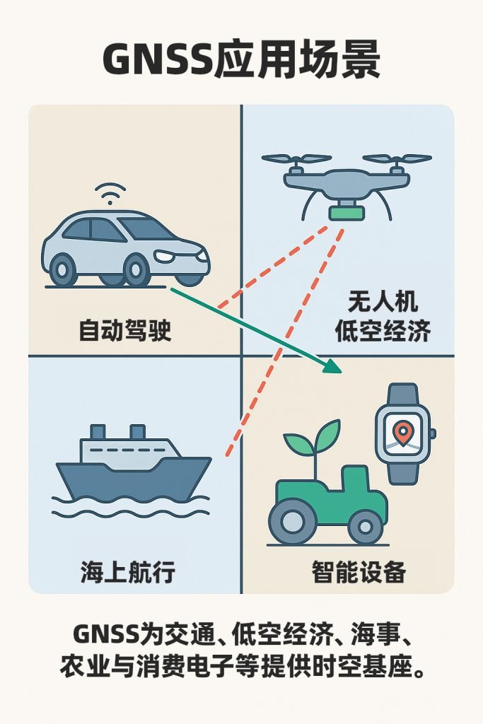
From smartphone navigation, food delivery, and drone aerial photography, to autonomous vehicles and embodied robots — they are all simultaneously answering one question:
“Where am I?”
And when the answer is off by even a few centimeters, the entire system can fail.

I. From Stars to Coordinates: The Evolution of Human Positioning
For thousands of years, humanity navigated by starlight and compass.
The position of the North Star indicated direction; the length of a sun shadow revealed the time.
When latitude and longitude were invented, humans translated “a sense of direction” into “a digitized position” for the very first time.
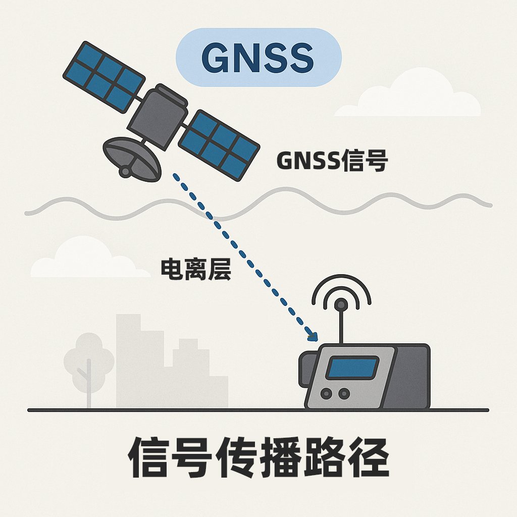
It was not until the 1970s that GPS transformed “location” into a computable physical quantity.
Satellites orbiting 20,000 kilometers above Earth continuously broadcast time-stamped signals; ground-based receivers measure the time differences in signal arrival to calculate distances.
The intersection of distances from four satellites converges on a single point — and that point is “where you are.”
II. The Art of Balancing Accuracy and Reliability
The math behind GNSS seems straightforward: time difference × speed of light = distance.
But light travels 300 meters in just one microsecond — meaning a time synchronization error of as little as 10 nanoseconds can introduce meter-level positioning errors.
In modern positioning, “accuracy” is no longer the only objective.
The true challenge is maintaining reliability across a wide range of extreme environments.
This is the design philosophy behind MOJANDA, our automotive-grade GNSS chip: to ensure system reliability built upon a foundation of high accuracy.
Through multi-constellation multi-frequency reception, an interference-resistant RF front end, and AI-powered algorithms, MOJANDA maintains stable positioning even under high temperatures, strong interference, and signal obstruction. This is not a trade-off of accuracy for reliability — it is a hardware-software integrated architecture that makes accuracy genuinely dependable.
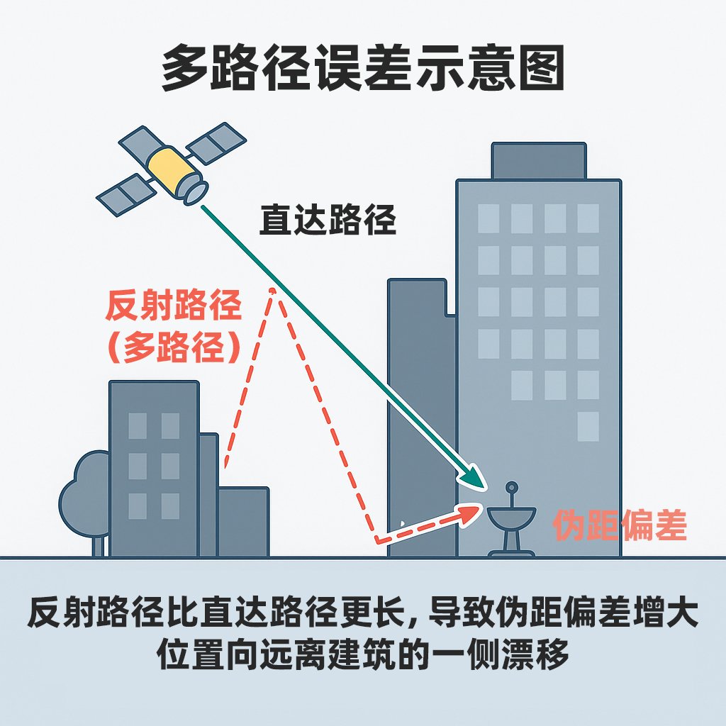
III. The Positioning Challenge in Urban Canyons
In open environments, satellite signals travel in a straight line to the receiver. But in urban “canyons,” signals bounce off tall buildings, and multipath effects cause the receiver to register false distances.
The result: your position drifts to the next lane on the map.
This is where the SUMACO INS module steps in.
Using gyroscopes and accelerometers to compute displacement in real time, it maintains accurate trajectory during the critical seconds when GNSS signal is lost.
And when the signal is restored, the REVENTADOR fusion algorithm platform automatically recalibrates for error, ensuring a continuous, jump-free trajectory.
“Reliable positioning is not about momentary precision — it is about sustained consistency.”
IV. From Position to Space: A Machine’s “Understanding”
When GNSS tells a machine “where I am,” the IMU tells it “how I’m moving,” and vision sensors and radar answer “what I see.”
When these three streams of information are fused together, the machine gains spatial perception — the ability to understand its environment.
It can not only determine “where I am,” but also predict “where I’m heading.” This is the core of spatial intelligence, and the embodiment of MCT’s “data-driven, hardware-software integration” philosophy: hardware provides accuracy, algorithms provide understanding, and data continuously makes the system more reliable.
V. Reflections and Insights
From gazing at the stars to find our way, to enabling machines to understand space — humanity has traveled this road for thousands of years.
Today, we can determine a position to within a few centimeters.
In the future, perhaps every vehicle, every drone, and every robot will inhabit the same high-precision spatiotemporal network.
But the question remains —
When machines know “where they are” more accurately than we do, do we still need a sense of direction?
📚 Further Reading
- Kaplan & Hegarty: Understanding GPS/GNSS: Principles and Applications (3rd ed.)
- Simon Winchester: The Map That Changed the World
- James Gleick: The Information
About MCT
MCT is an innovative company dedicated to attitude sensing and absolute positioning for the era of Physical AI. With artificial intelligence at the core of our technology, we adopt a “data-driven, hardware-software integration” strategy to develop and deliver comprehensive hardware and software solutions for attitude sensing and absolute positioning. Our solutions serve sectors including embodied intelligence, urban-area assisted driving, low-altitude economy, robotics, and smart devices. Built upon our proprietary automotive-grade BeiDou high-precision chips and modules, and integrating high-precision IMU, vision, and radar sensor technologies with large-scale datasets, MCT provides more reliable, safer, and more accurate technical support for autonomous planning and automated control — continuously enhancing the spatial perception capabilities of the platforms we power.
Want to learn more about MCT’s latest developments? Visit www.mctech.ai / www.mctai.cn, or follow our official WeChat account “毫厘智能 MCT”.