Beyond Positioning: How Spatial Intelligence Makes the World Better
Prologue: Back to the Beginning

Two years ago, we guided a tiny chip
to find its own coordinates amid the vast ocean of satellite signals.
In that moment, a machine “knew” where it was for the very first time.
That was not merely a string of numbers — it was the first spark of awareness.
From that point on, MCT set out on a path of no return —
a path that bridges technology and trust, data and human life.
The true greatness of technology lies not in computing faster, but in making the world clearer and more trustworthy.
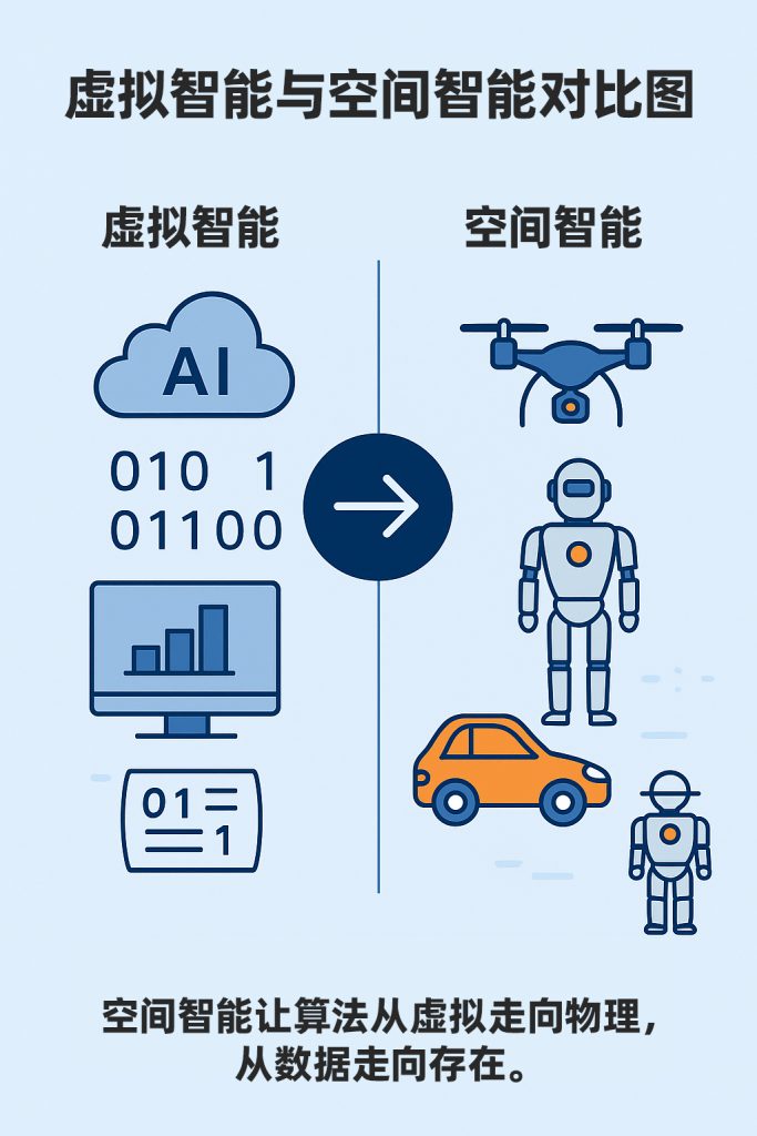
I. Spatial Intelligence: The Bridge Between the Virtual and the Real
For a long time, intelligence lived behind screens.
Algorithms ran in virtual environments; data cycled through the cloud.
It could answer questions, but it could not understand space.
Spatial intelligence is different.
It brings intelligence back into the physical world,
allowing “understanding” to take place within real, physical space.
A chip, a set of algorithms, a machine — through countless computations interacting with the environment — together form the physical embodiment of intelligence.
This intelligence is no longer purely “software-based” or “data-driven.”
It simply exists —
operating in the real world: on the ground, in the air, inside vehicles, and across factory floors,
transforming the way we perceive and understand our world.
II. From Positioning to Understanding
In the beginning, we were solving a single problem:
making positioning more precise.
But through iteration after iteration — tuning, testing, and optimizing —
we came to realize that positioning is not the destination. It is the starting point.
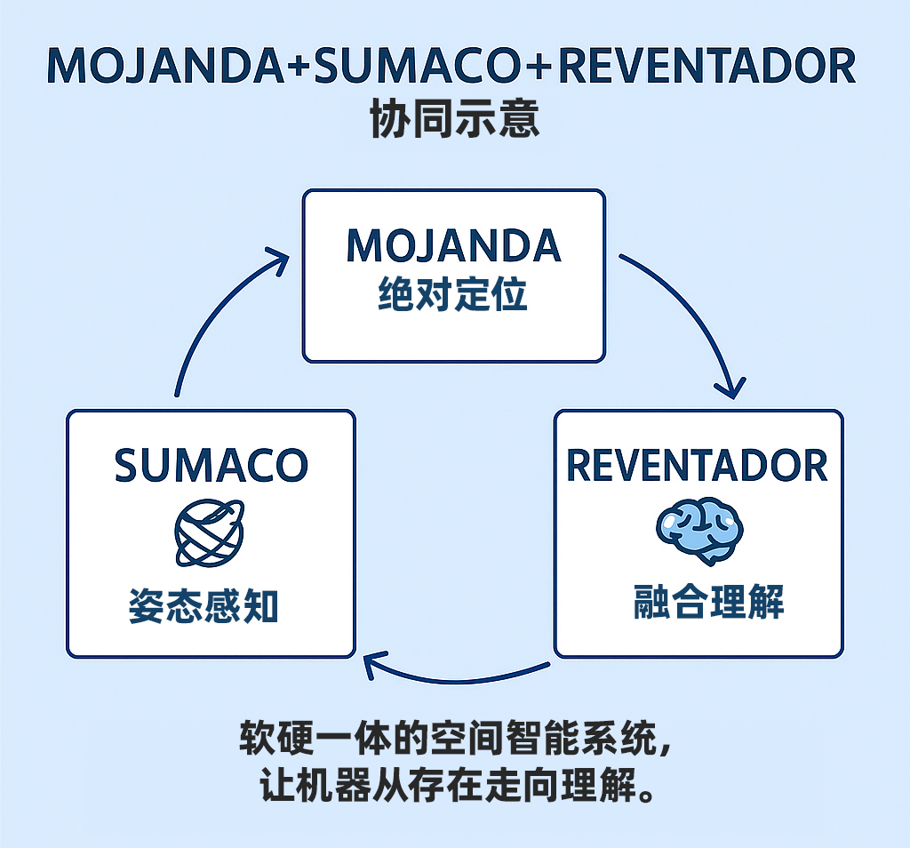
MOJANDA is more than a “chip” —
it is the means by which a machine comprehends the Earth.
SUMACO is more than an “INS module” —
it is the “body” through which a machine senses motion.
REVENTADOR is more than an algorithm —
it is the “cognitive layer” that gives data logic and meaning.
When all three work in concert,
a machine becomes capable of understanding itself for the first time.
Positioning gives machines presence. Understanding gives machines growth.
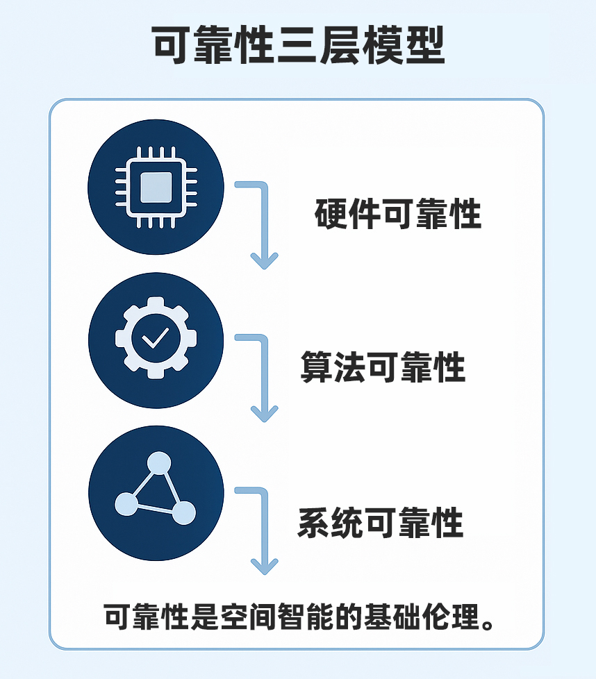
III. Reliability: The Ethical Foundation of Intelligence
In the world of technology, “reliability” is not a marketing term — it is an ethical imperative.
It means respecting reality, respecting safety, and respecting human life.
Every algorithm optimization, every calibration validation, every system integration at MCT points toward the same core principle: ensuring the system is trustworthy under any condition.
Automotive-grade design is a statement of intent.
It tells the world:
this technology can be depended upon.
Reliability is not a cold engineering parameter —
it is intelligence’s commitment to the world.
Only when intelligence is reliable does it deserve to be trusted.
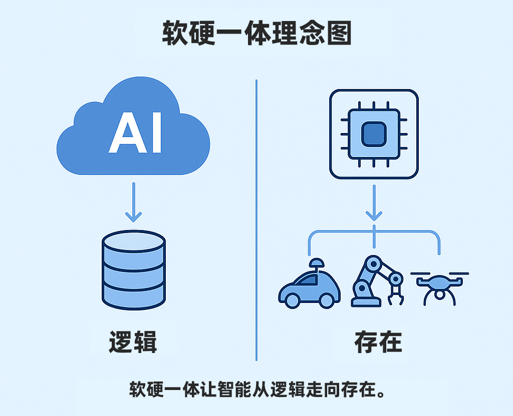
IV. Hardware-Software Integration: Giving Intelligence a Physical Form
Traditionally, chips were hardware and algorithms were software.
Each evolved on its own track, largely separate from the other.
MCT chose a harder path:
bringing the two together.
In the transistors of MOJANDA, in the gyroscopes of SUMACO, in the code of REVENTADOR — the same design philosophy runs through all of them: binding data tightly to the physical world.
This is the essence of hardware-software integration —
not a stacking of technologies,
but the embodiment of intelligence itself.
Only when algorithms touch the world do they truly understand it.
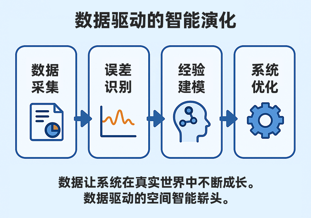
V. Data-Driven: Turning Experience into Wisdom
Within a spatial intelligence system,
every perception event, every trajectory, every signal frame
is generating new understanding.
This goes beyond training models —
it is about allowing machines to accumulate “experience” through data.
Experience forms patterns; patterns form cognition.
Just as humans come to understand the world through lived experience,
machines build their own “worldview” through data.
This is the power of a data-driven approach —
not to replace thinking, but to extend understanding.
VI. The Significance of Spatial Intelligence
Spatial intelligence is not an industry buzzword —
it is a new way of understanding the world.
It connects perception with action,
the individual with the environment,
and technology with responsibility.
When machines gain the ability to understand space,
they do more than help humans navigate —
they reshape the relationship between humanity and the world itself.
From autonomous driving to embodied AI,
from low-altitude aviation to smart cities,
spatial intelligence is becoming the new language of the physical world.
It helps the world be seen more clearly, understood more deeply, and connected more meaningfully.
VII. Reflection and Outlook
At its deepest level, technology is not a cold formula —
it carries warmth.
When an intelligent system becomes reliable, interpretable, and sustainable,
it evolves from a “tool” into a “partner.”
MCT’s mission has never changed — to make the world better through spatial intelligence.
This is not a slogan —
it is a conviction.
It means:
we measure the Earth with chips,
interpret motion with algorithms,
connect space with data,
and ultimately, help every entity in the world be better understood.
When technology gains the capacity to understand, the world becomes a little more humane.
Further Reading
- Norbert Wiener. Cybernetics: Or Control and Communication in the Animal and the Machine, MIT Press, 1965
- Andy Clark. Being There: Putting Brain, Body, and World Together Again, MIT Press, 1997
- Shoshana Zuboff. The Age of the Smart Machine, Basic Books, 1988
About MCT
MCT is an innovative company focused on attitude sensing and absolute positioning for the Physical AI era. With artificial intelligence at its core, MCT adopts a “data-driven, hardware-software integrated” strategy to develop and deliver comprehensive attitude sensing and absolute positioning solutions — spanning both hardware and software — for applications in embodied AI, urban-area assisted driving, low-altitude aviation, robotics, and intelligent devices. Built on proprietary automotive-grade BeiDou high-precision chips and modules, and integrating high-precision IMU, vision, and LiDAR sensor technologies with large-scale data, MCT provides more reliable, safer, and more precise technical support for autonomous planning and automatic control, continuously enhancing the spatial awareness capabilities of the platforms it serves.
Want to learn more about MCT’s latest developments? Visit www.mctech.ai / www.mctai.cn, or follow our official WeChat account: “毫厘智能 MCT”.